


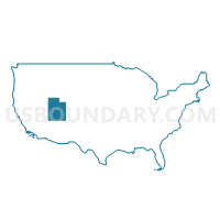
Southeast Utah & Uintah Basin Region PUMA, Utah
About
Outline

Summary
| Unique Area Identifier | 194248 |
| Name | Southeast Utah & Uintah Basin Region PUMA |
| State | Utah |
| Area (square miles) | 27,257.23 |
| Land Area (square miles) | 27,025.46 |
| Water Area (square miles) | 231.77 |
| % of Land Area | 99.15 |
| % of Water Area | 0.85 |
| Latitude of the Internal Point | 39.08144100 |
| Longtitude of the Internal Point | -110.05436750 |
Maps

Graphs
Select a template below for downloading or customizing gragh for Southeast Utah & Uintah Basin Region PUMA, Utah


Neighbors
Neighoring Public Use Microdata Area (by Name) Neighboring Public Use Microdata Area on the Map
- Cache, Summit, Morgan & Rich Counties PUMA, UT
- Coconino County--Flagstaff City PUMA, AZ
- La Plata, Montezuma, Gunnison, Archuleta, Dolores, Hinsdale & San Juan Counties PUMA, CO
- Mesa (Outside Grand Junction City), Montrose, Delta, San Miguel & Ouray Counties PUMA, CO
- Navajo & Apache Counties PUMA, AZ
- Northwest Colorado--Garfield, Routt, Moffat & Rio Blanco Counties PUMA, CO
- Northwest New Mexico--Navajo Nation PUMA, NM
- Salt Lake County (Southeast)--Sandy (North), Cottonwood Heights & Midvale Cities PUMA, UT
- Southwest & South Central Utah (Outside Washington County)--Cedar City PUMA, UT
- Sweetwater, Fremont, Uinta, Sublette & Hot Springs Counties--Wind River Reservation PUMA, WY
- Utah County (East)--Spanish Fork, Springville, Lehi (Northeast) & Highland Cities PUMA, UT
Top 10 Neighboring County (by Population) Neighboring County on the Map
- Salt Lake County, UT (1,029,655)
- Utah County, UT (516,564)
- Mesa County, CO (146,723)
- Coconino County, AZ (134,421)
- San Juan County, NM (130,044)
- Navajo County, AZ (107,449)
- Apache County, AZ (71,518)
- Garfield County, CO (56,389)
- Sweetwater County, WY (43,806)
- Montrose County, CO (41,276)
Top 10 Neighboring County Subdivision (by Population) Neighboring County Subdivision on the Map
- American Fork-Pleasant Grove CCD, Utah County, UT (121,452)
- Springville-Mapleton CCD, Utah County, UT (42,473)
- Tuba City CCD, Coconino County, AZ (31,639)
- Vernal CCD, Uintah County, UT (26,835)
- Park City CCD, Summit County, UT (24,696)
- Fruita CCD, Mesa County, CO (23,655)
- Cortez CCD, Montezuma County, CO (16,796)
- Shiprock-Sanostee CCD, San Juan County, NM (16,634)
- Price CCD, Carbon County, UT (16,181)
- Roosevelt CCD, Duchesne County, UT (14,760)
Top 10 Neighboring Place (by Population) Neighboring Place on the Map
- Heber city, UT (11,362)
- Vernal city, UT (9,089)
- Price city, UT (8,715)
- Park City city, UT (7,558)
- Roosevelt city, UT (6,046)
- Moab city, UT (5,046)
- Midway city, UT (3,845)
- Maeser CDP, UT (3,601)
- Blanding city, UT (3,375)
- Helper city, UT (2,201)
Top 10 Neighboring Unified School District (by Population) Neighboring Unified School District on the Map
- Alpine School District, UT (284,505)
- Canyons School District, UT (204,224)
- Mesa County Valley School District 51, CO (143,321)
- Nebo School District, UT (119,571)
- Central Consolidated Schools, NM (33,082)
- Uintah School District, UT (32,588)
- Park City School District, UT (24,401)
- Wasatch School District, UT (23,530)
- Carbon School District, UT (21,403)
- Sevier School District, UT (20,802)
Top 10 Neighboring State Legislative District Lower Chamber (by Population) Neighboring State Legislative District Lower Chamber on the Map
- State House District 2, AZ (177,904)
- State House District 54, CO (86,291)
- State House District 57, CO (78,537)
- State House District 58, CO (78,435)
- State House District 27, UT (49,237)
- State House District 65, UT (49,224)
- State House District 67, UT (42,669)
- State House District 54, UT (42,563)
- State House District 55, UT (38,435)
- State House District 53, UT (37,757)
Top 10 Neighboring State Legislative District Upper Chamber (by Population) Neighboring State Legislative District Upper Chamber on the Map
- State Senate District 2, AZ (177,904)
- State Senate District 7, CO (152,044)
- State Senate District 13, UT (150,707)
- State Senate District 8, CO (148,629)
- State Senate District 6, CO (144,787)
- State Senate District 11, UT (137,882)
- State Senate District 26, UT (101,392)
- State Senate District 28, UT (94,905)
- State Senate District 27, UT (93,972)
- State Senate District 19, UT (91,855)
Top 10 Neighboring 111th Congressional District (by Population) Neighboring 111th Congressional District on the Map
- Congressional District 3, UT (966,232)
- Congressional District 1, UT (906,660)
- Congressional District 2, UT (890,993)
- Congressional District 1, AZ (774,310)
- Congressional District 3, CO (706,186)
- Congressional District 3, NM (693,284)
- Congressional District (at Large), WY (563,626)
Top 10 Neighboring Census Tract (by Population) Neighboring Census Tract on the Map
- Census Tract 9405, Wasatch County, UT (8,614)
- Census Tract 9405, Duchesne County, UT (7,632)
- Census Tract 9721, Sanpete County, UT (7,630)
- Census Tract 9682, Uintah County, UT (7,450)
- Census Tract 15.02, Mesa County, CO (7,214)
- Census Tract 9406, Duchesne County, UT (7,128)
- Census Tract 9521, Garfield County, CO (6,041)
- Census Tract 9602, Wasatch County, UT (5,920)
- Census Tract 9684.02, Uintah County, UT (5,779)
- Census Tract 9402.01, Uintah County, UT (5,753)
Top 10 Neighboring 5-Digit ZIP Code Tabulation Area (by Population) Neighboring 5-Digit ZIP Code Tabulation Area on the Map
- 84604, UT (49,145)
- 84062, UT (43,269)
- 84003, UT (42,384)
- 84121, UT (41,702)
- 84092, UT (29,525)
- 82901, WY (27,971)
- 84078, UT (25,851)
- 84098, UT (17,282)
- 84032, UT (17,249)
- 81521, CO (15,397)